Stream ID
Minnesota Department of Natural Resources (MNDNR) stream ID M-055-004-000.5.
Minnesota Pollution Control Agency identifier H33143001. Hydrologic Unit Code 07020012-914. Also known as Kinnely Creek at Nicols Road and Kennealy’s, Kenally’s, or Kennaly’s Creek.
Kennaley’s Creek is a less than one mile (1.6 kilometers) long, MNDNR-designated, cold-water trout stream in the city of Eagan within Dakota County, Minnesota. The creek is a tributary to the Minnesota River, and its streamflow is sustained mostly by groundwater.
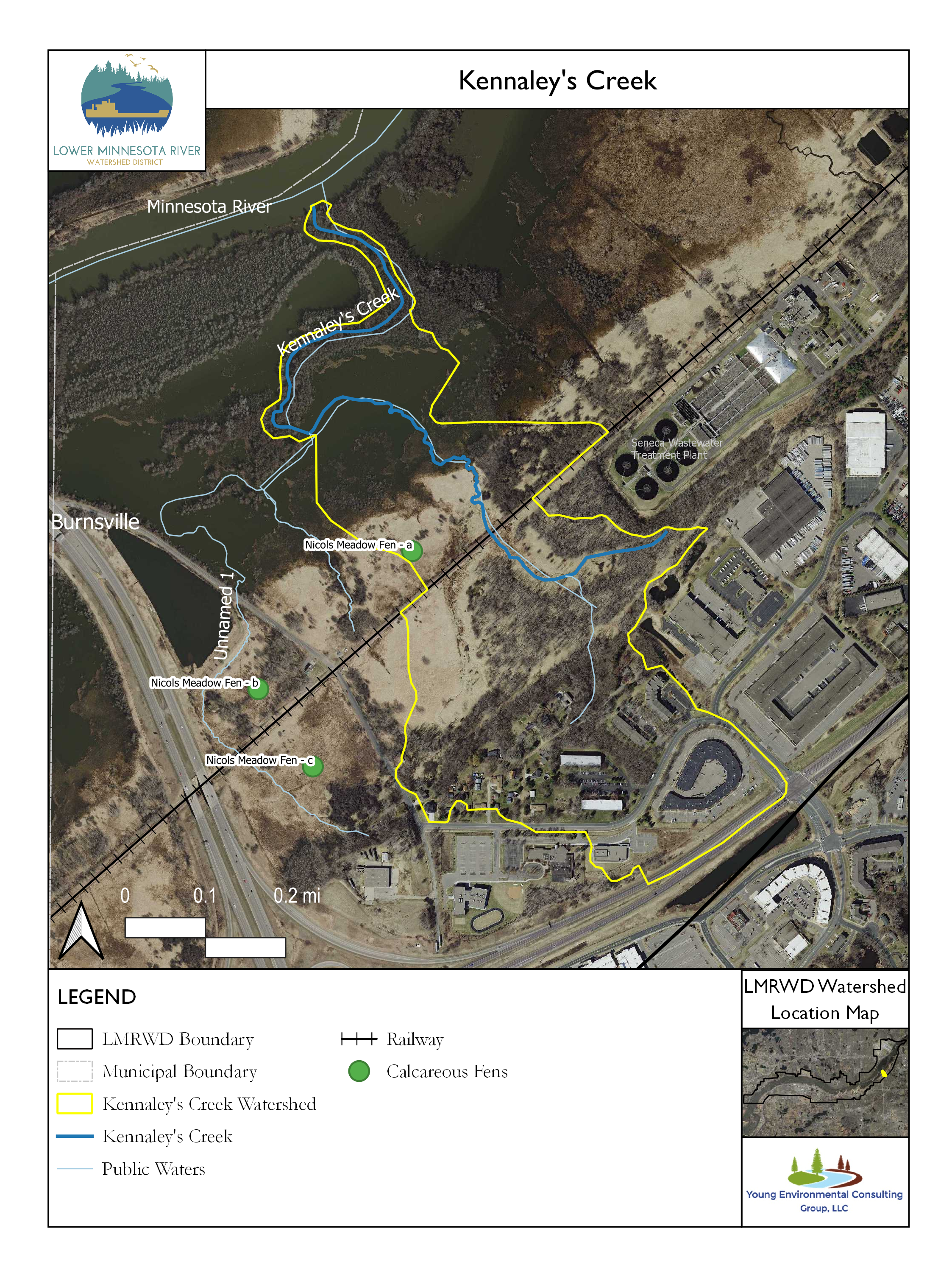
The image below shows Kennaley’s Creek where the west branch joins the mainstem from the southeast and then passes under the Union Pacific Railroad. The Seneca Wastewater Treatment Plant aeration ponds are in the upper right corner of the image and Nicols Road is in the lower left. The creek originates from a series of groundwater springs and seeps south of the railway, and then passes under the railway via a five-foot metal culvert.
Access to Kennaley’s Creek is limited because the only stream crossing is on the private property of the Union Pacific Railroad. The only public access to the creek is to walk the uneven, sometimes wet ground on public land adjacent to the railway.
Historically, Kennaley’s Creek supported a self-sustaining brook and brown trout fishery. Studies have been done to determine whether the trout fishery can be re-established. Occasional stream assessments conducted across several decades suggest that the stream does not have a healthy enough habitat to maintain a self-sustaining fishery in its current condition. Improvements to the stream habitat, which include increasing baseflow, adding structures to improve the complexity of the stream floor, and enhancing streambank vegetation, could only be made with significant effort and might not be worth the investment (Young 2022).
Streamflow to Kennaley’s Creek may also be inadequate to sustain a trout fishery. The Metropolitan Council of Environmental Services (MNDNR) monitors groundwater levels to assess whether dewatering at their nearby Seneca Wastewater Treatment facility can be reduced to provide a greater constant flow to the stream. The MNDNR and the Dakota County Soil and Water Conservation District also monitor groundwater associated with Nicols Meadow Fen, which is southwest of the creek. These efforts, combined with a greater understanding of the relationship between groundwater and the amount of water carried by the creek, might improve the habitat and trout viability.
There are no ongoing data collection efforts that provide relevant information about Kennaley’s Creek.
References
Young. 2022. Trout Streams Gaps Analysis - Draft Report. Chaska, MN: Lower Minnesota River Watershed Disctrict.
This data was last updated June 2022.